Category: Things

Things

Small Finds

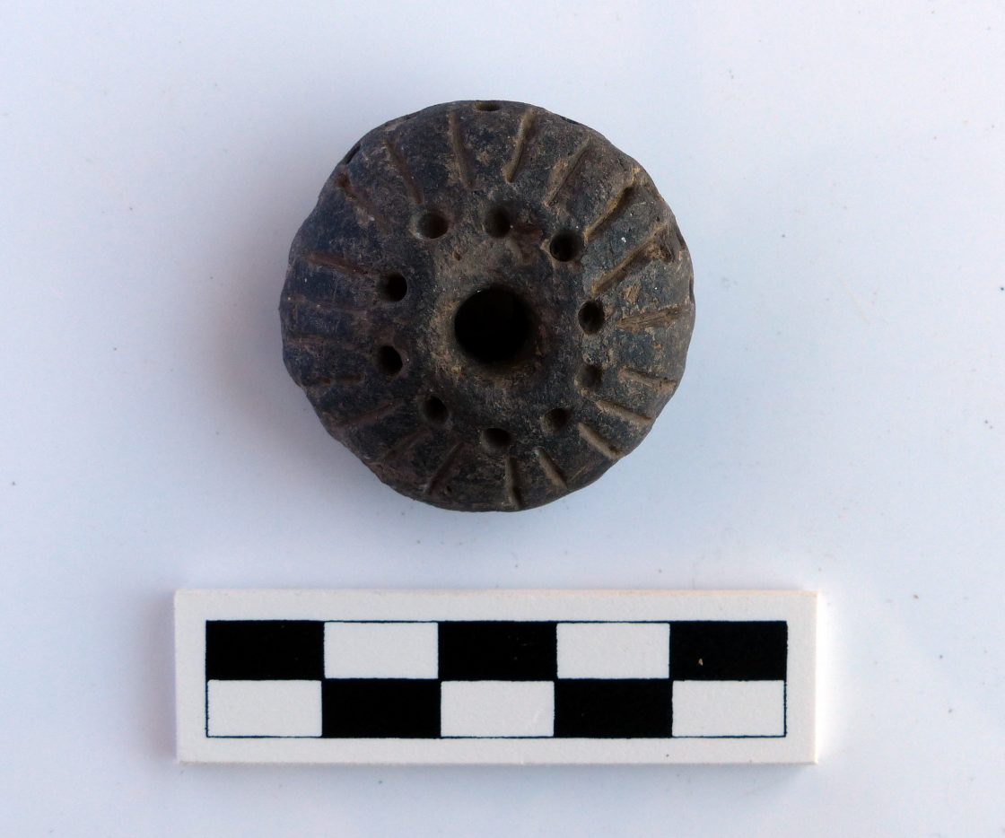
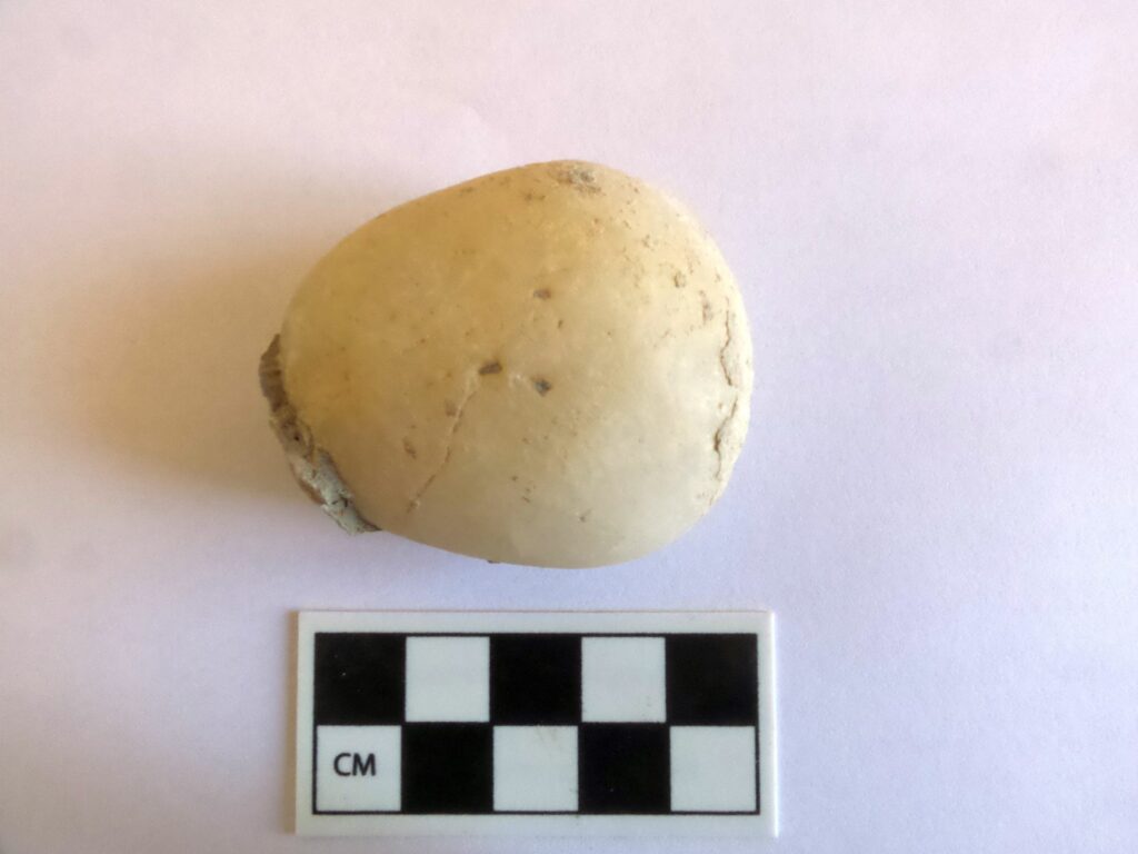
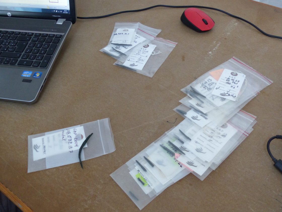
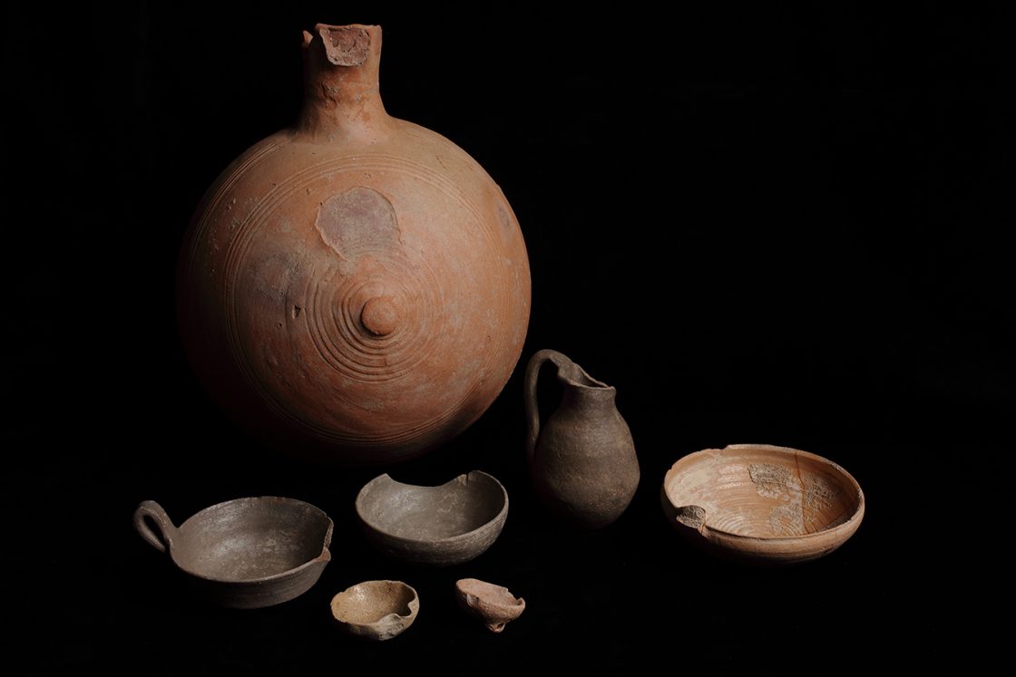
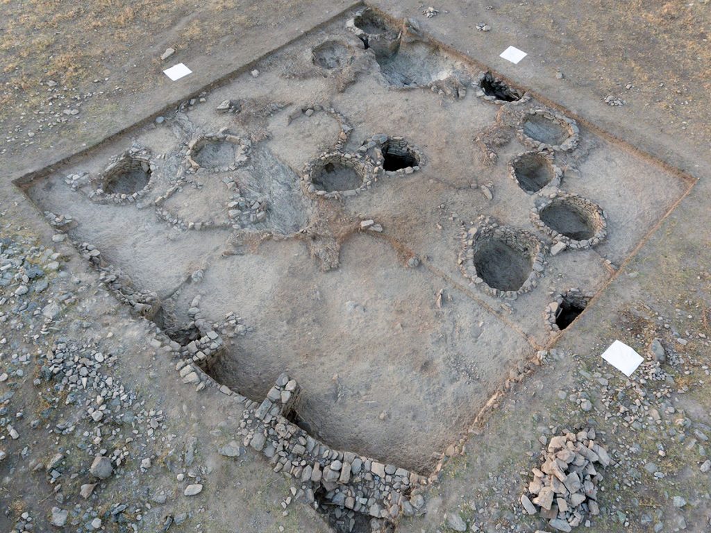
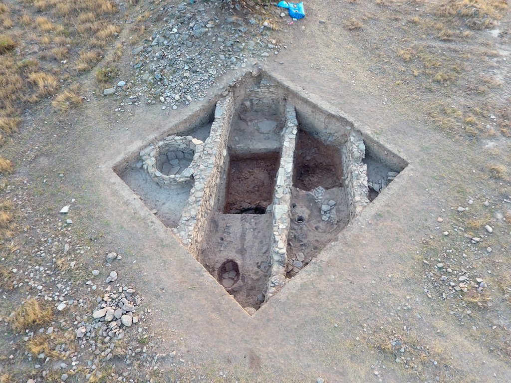
“Small finds” refer to a variety of generally “small” artifacts in diverse materials. Often studied according to narrow material classes, their functions have great potential for understanding different productive activities carried out in antiquity. Among these, textile production is represented well at Kaymakçı by numerous clay spindle whorls and loom weights, in addition to bronze needles. Perforated round sherds are also interpreted as weights of some sort, although some of them might have been used otherwise, as scrapers, for instance. Bone “gorgets” and bronze hooks represent fishing equipment likely used in the nearby lake. A wide variety of other bone, stone, and bronze tools (such as handles, awls, and chisels), together with personal ornaments, represent other common items in the collection of small finds from Kaymakçı.

Affiliated team personnel

Magda Pieniążek, Tübingen University
Caitlin O’Grady, University College London
Jana Mokrisová, Birkbeck College, University of London


Ottoman Studies

Intensive “digging” into the Presidential Ottoman Archives and Robert College-Boğaziçi University Archives in Istanbul has proved to be extraordinarily interesting for the historical importance of Lake Marmara, the Gediz River, and early archaeology in the region (Bin Tepe and Sardis). Current archival research relates to the period between the late 16th and early 20th centuries. The Middle Gediz Valley is a rich territory for Ottoman narratives on climate change, agricultural production, wetland management, and property relations throughout the period under Ottoman rule. Waqfs (pious foundations) controlled major areas of the region. Princes residing in the palace of nearby Manisa from the 15th to the 17th century played major roles in the waqf management of agricultural land in the valley as well as of the waters and surrounding wetlands of Lake Marmara. Unique historical trajectories define land and lake basin management in the face of dramatic climatic shifts during the Little Ice Age. Current research focuses on the Halime Hatun waqf, which included major components of agricultural and lake resources (fishing, reeds, leeches, etc.). Revenue from taxes collected by the waqf funded the Halime Hatun complex in Gölmarmara, including a mosque, medrese, soup-kitchen, and hammam. These places are today part of Gölmarmara’s Ottoman heritage. The dynamic landscapes of the lake basin offer a hub for exploring the varying scales of global climate shifts among local, imperial, and inter-imperial actors.

In fact this research also gives us the opportunity to place this region firmly within the networks of 18th century Izmir, a major commercial port that connected the middle Gediz Valley to the wider world. This entry triggered increasing competition over land and lake management in the late 18th and thru the early 20th century. Here our work explores Ottoman and non-Ottoman merchants; tax-farmers who competed to gain access to revenues from Lake Marmara, the fertile land, and mines; Cossack refugees who settled in the region as early as the 1830s and made good use of their expertise of socio-ecological knowledge on wetland ecologies to compete with the predominantly Orthodox Greek fishing communities; and local ayan families like the Karaosmanoğlu, who held economic as well as political power in the region. While trying to access and control the resources in the valley, and especially of Lake Marmara, lake communities (intentionally as well as unintentionally) negotiated the micro-climate of the valley and the natural history of Lake Marmara within the context of changing climate and property relations, notably the Tanzimat shifts. This eventually resulted with the emergence of lake management policies.

Finally, another important and emerging part of our archival work focuses on the narratives of early archaeologists, from Bin Tepe to Sardis. We’re interested in their agendas, their engagement with modernity, their relationships with Ottoman officials, and the role of conservation and presentation in Turkey, from the late 18th through the mid-20th century.

Affiliated team personnel

Semih Çelik, Koç University


Metals

Within the various categories of small finds, metal objects play a fundamental role in the reconstruction of everyday practices, craft activities, technological skills, and stylistic choices in ancient cultures. At Kaymakçı, as elsewhere across Anatolia in the second millennium BCE, the metal corpus includes mainly lead and copper-alloyed artifacts, ranging from tools to personal ornaments and weaponry. The abundant presence of small tools such as chisels, awls, and needles testifies to the richness and variety of specialized on-site activities, such as textile production. Stylistic elements of both utilitarian and more prestigious items show a combination of local elements as well as influences from Anatolian and Aegean cultural spheres.

All metal finds from Kaymakçı are typologically examined and categorized to trace differences and similarities with the same categories of artifacts from contemporary sites in other regions. In addition, archaeometric methods of analysis (pXRF, SEM-EDXRF, LIA, etc.) are applied to examine the elemental composition, microstructure, and isotopic signature of metal objects to better understand the technological skills, manufacturing choices, and routes of raw material procurement behind their making.

Affiliated team personnel

Dalila Alberghina, Koç University
Caitlin O’Grady, University College London
Magda Pieniążek, Tübingen University


Conservation

Current conservation efforts at Kaymakçı focus on site-level support for excavations at Kaymakçı and the processing, stabilization, and curation of archaeological materials. An ongoing training program pairs an expert conservator with students. Working with primary data, the conservation team focuses on stabilization of materials, from metals and glass to ceramics and pigments. A conservation laboratory at the research center allows for primary treatment of study materials prior to storage and transfer to the regional Manisa Museum of Archaeology and Ethnography. In addition, the conservation team oversees the excavation process, consulting as necessary when fragile or unique contexts require especially careful extraction. The conservation team also manages the closing of excavation areas with protective coverings (geotextile) at the end of each season as well as their opening at the beginning of subsequent seasons.

Affiliated team personnel

Caitlin O’Grady, University College London


Ceramics

Pottery fragments represent the most conspicuous category of archaeological materials found both on the surface and within the buried layers of archaeological sites. From the CLAS dataset, our project has been working to establish the first broad-scale typology for the region. Of course, detailed excavations at Kaymakçı and at nearby Sardis, provide “anchors” that allow us to refine specific windows of time. So far the chronology from Kaymakçı has yielded a rich repertoire of pottery, with the best-documented categories being ware types representative of the mid and late second-millennium BCE ceramic horizon of the region. In particular, Red-Light Brown (RLB), Gray, and Red-and-Brown Coarse (RBC) wares constitute the major groups of the Kaymakçı pottery assemblage.

Past ceramic analyses focused on studies of production over time. Here our researchers explored the chemical fingerprints from neutron activation analysis of ceramics to demonstrate likely shifts in workshop organization. As we might expect, during periods of low occupation and rural hamlets, production was decentralized; yet during periods of urbanization, production was far more centralized.

Future studies are focusing on identity and performance, as indicated by surface treatment. Of special interest is the local gold and silver wash as well as painted wares of the second-millennium BCE indicative of foreign connections. In addition, researchers are engaged in new technologies of documentation and analysis, from 3D scanning and laser profiling to thin-section petrography, scanning electron microscopy (SEM), x-ray florescence (XRF), and Raman spectroscopy.

Affiliated team personnel

Peter Pavúk, Charles University
Tunç Kaner, Koç University
Peter Demján, Charles University


Excavations at Kaymakçı

The Kaymakçı Archaeological Project began in 2014 with aims of conducting excavations and related research activities at and around Kaymakçı, a Middle and Late Bronze Age site located overlooking the western shore of Lake Marmara. Kaymakçı consists of a fortified citadel as well as dispersed extramural settlement and other remains. It is the largest known site of its period in the Gediz River valley and must have been a significant regional capital. The excavation of Kaymakçı promises gains for both the scientific knowledge of second-millennium BCE central western Anatolia and its links to the Aegean and Anatolian worlds. Geophysical prospection, excavations, and conservation and restoration activities are revealing and preserving the site’s architecture while an international team of scholars and students study material and environmental evidence to shed light on the ancient communities of Kaymakçı and the world they inhabited.

The Site

The citadel of Kaymakçı is located on top of a ridge of mica-schist bedrock around 140 meters above the level of Lake Marmara. With its main occupational phase dating to the Middle and Late Bronze Age periods, Kaymakçı represents not only the largest of the six contemporary citadels in the Marmara Lake basin discovered in the course of the Central Lydia Archaeological Survey (CLAS), but also, with its 8.6 ha enclosed space, the largest second-millennium BCE citadel in western Anatolia known to date. Based on both its archaeological evidence and the historical geography of western Anatolia as reconstructed from Hittite textual sources, Kaymakçı is one of the most likely candidates to be the capital of the LBA kingdom of the Seha River Land.

The first several years of excavations have focused on the three primary components of the citadel: the fortification system (areas 81.551 and 95.555); the inner citadel and surrounding slopes (areas 93.545, 97.541, and 98.531), and the southern terrace (areas 99.526 and 108.523/109.523). Based on identified ceramic and/or architectural phases, current understandings of the second-millennium BCE chronology of the citadel differentiate a limited occupation during the MBA (represented by ceramics alone at present) from more intensive phases of LBA occupation that are further divided into an earlier LB 1 phase (17th to 15th centuries BCE) and a later LB 2 phase (14th–13th centuries BCE). Limited ceramic collections may represent either terminal Late Bronze or very early Iron Age activities at the site, after which time it appears to have been thoroughly abandoned.

Ongoing excavations within and future excavations outside the citadel are hoped to shed more light on the mystery of Kaymakçı’s abandonment – induced from human-derived or environmental conditions or a combination of the two – and may illuminate also the full extent the site in extramural settlement and cemetery areas up the ridge, on the slopes of the ridge, and along the lakeshore.


Excavation Areas

This 9 x 9-meter excavation area is located along the fortification system in the northwestern-most part of the citadel. Excavations aiming to confirm geophysical results and explore the date and style of fortifications. Large bastion-like features with 2-meter wide walls, already visible in geophysical results, were built here in the local LB 2 phase, strengthening the fortifications in this otherwise vulnerable location.
Supervisors: K. Egerer (2014); E. Kaner (2019).

This L-shaped area consisting of a 9 x 29-meter rectangle and 9 x 9-meter addition, are located along the northern fortifications of the citadel. Excavations aimed to test geophysical results suggestive of a gate structure. Several phases of building and living activity are attested in the area, including the original construction of the 2-meter wide LB fortification wall and subsequent LB modifications, including several buildings and a possible gateway.
Supervisors: K. Egerer (2015); E. Kaner (2019).

This 19 x 19-meter excavation area is situated in the uppermost, almond-shaped terrace of the inner citadel of Kaymakçı. Excavations aiming to determine the date and function of this this most-protected space of the citadel have revealed its 1.5-meter wide circuit wall and a large, seemingly open space occupied by at least 16 semi-subterranean circular features. Built using a combination of cut bedrock and drywall techniques, these were likely used originally as grain silos or other storage facilities and were emptied and filled with secondary deposits over the course of the local LB 1 and LB 2 phases.
Supervisors: D. Plekov (2015, 2016); C. Scott (2015).

Excavation of this 19 x 19-meter area located on the lower, outer terrace of the inner citadel of Kaymakçı aims to explore the date and function of this area of the inner citadel and have revealed semi-subterranean storage features similar to those unearthed in other areas of the site, as well as at least three building complexes situated opposite a narrow corridor and open courtyard. The buildings are internally articulated into smaller rooms, some of which are paved with flagstones, and include installations such as ovens/hearths and large pithoi, or storage jars. Ceramics retrieved from stratified layers suggest a period of use spanning the local LB 1 and LB 2 phases.
Supervisors: H. Chastene (2015); C. Scott (2019).

This 9 x 9-meter area is located on the southern, lower slope of the inner citadel, near its junction with the southern terrace. Excavations aim to test geophysical results and explore the date and use of a large building complex. Excavations to date have revealed a roughly square space abutted by several smaller walled spaces probably used for storage purposes during the local LB 1 and LB 2 phases.
Supervisor: N. Susmann (2014).

This 9 x 9-meter area is located near the southwester edge of the Kaymakçı’s southern terrace. Aiming to elucidate geophysical results showing the clearly delineated walls of a building complex, excavations here were continued down to bedrock and represent the fullest LB sequence of activities recovered to date. Early LB 1 fills and other evidence suggest initial use for open-area activities. By the LB 1-2 transition, the area was built up with elongated buildings and continued to be used for mixed domestic, household industry, and storage purposes over several subphases.
Supervisors: A. Crowe (2014, 2015); C. Scott (2016); E. Kaner (2018).

Excavation of this 19 x 19-meter area located in center of Kaymakçı’s southern terrace aims to explore geophysical results suggestive of the area’s “urban” character, with streets and alleys dividing blocks of building complexes. Revealed at the southwestern corner of the area, a wide pebble-paved street appears to connect the outer fortifications with the inner citadel. Immediately northeast of and abutting the street are at least three long and rectilinear building complexes separated by narrow alleys. The occupational sequence is similar to that of 99.526: the earliest levels show traces of open-air activities and the following LB 2 phases are characterized by large architectural complexes of mixed domestic, household industry, and storage uses.
Supervisors: J. Mokrišová (2014, 2015); D. Alberghina (2018, 2019).