Category: Excavation

Ceramics

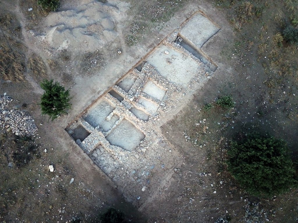
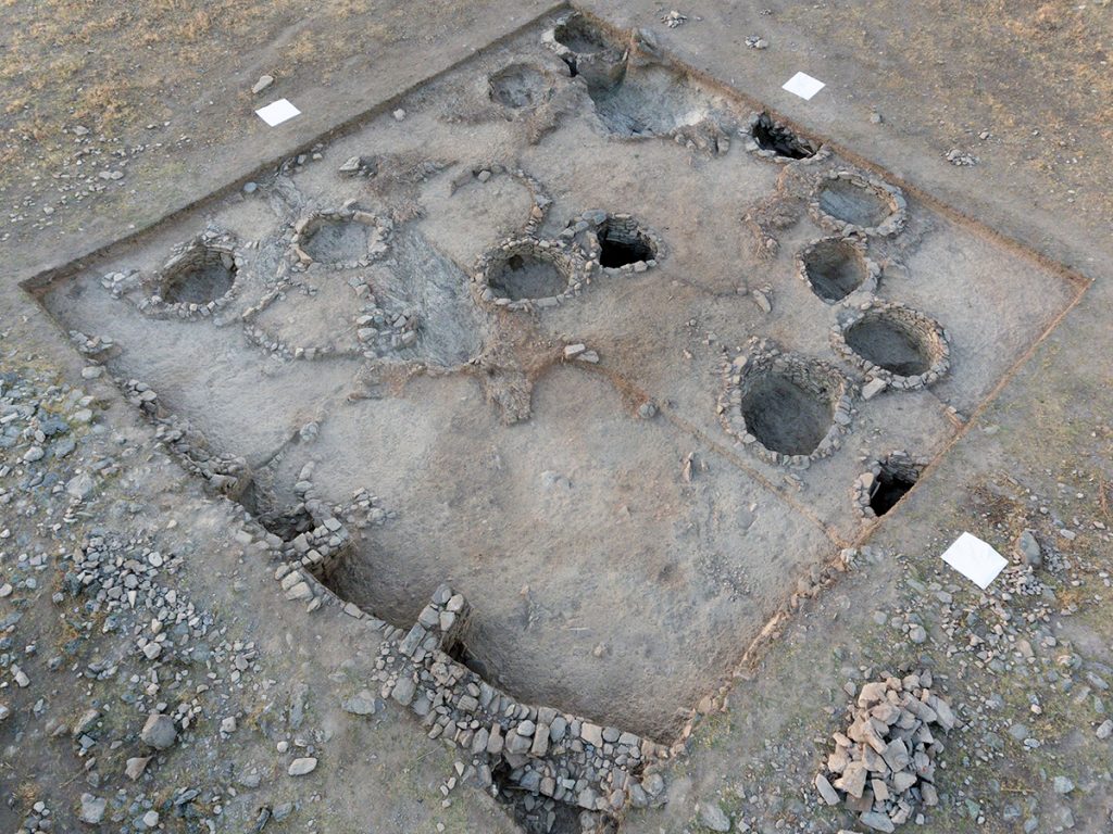
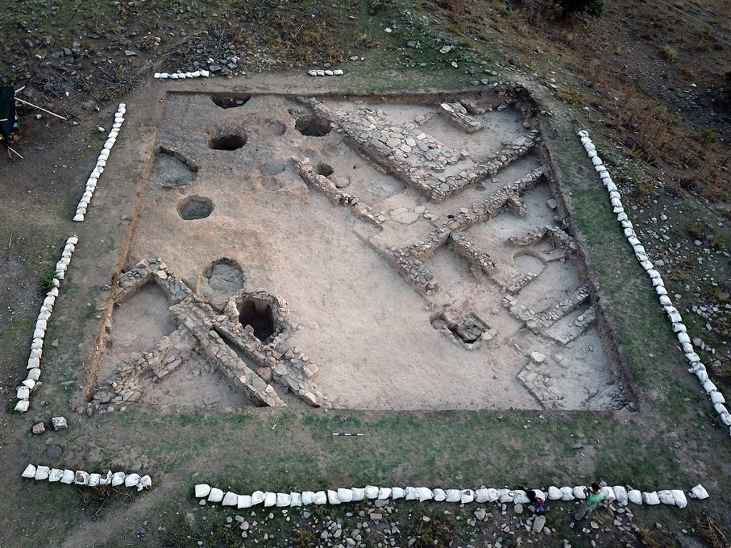
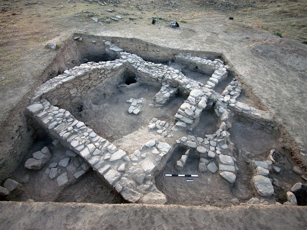
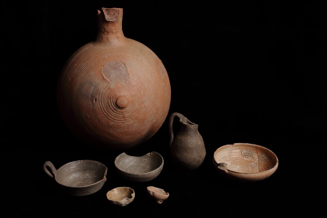
Pottery fragments represent the most conspicuous category of archaeological materials found both on the surface and within the buried layers of archaeological sites. From the CLAS dataset, our project has been working to establish the first broad-scale typology for the region. Of course, detailed excavations at Kaymakçı and at nearby Sardis, provide “anchors” that allow us to refine specific windows of time. So far the chronology from Kaymakçı has yielded a rich repertoire of pottery, with the best-documented categories being ware types representative of the mid and late second-millennium BCE ceramic horizon of the region. In particular, Red-Light Brown (RLB), Gray, and Red-and-Brown Coarse (RBC) wares constitute the major groups of the Kaymakçı pottery assemblage.

Past ceramic analyses focused on studies of production over time. Here our researchers explored the chemical fingerprints from neutron activation analysis of ceramics to demonstrate likely shifts in workshop organization. As we might expect, during periods of low occupation and rural hamlets, production was decentralized; yet during periods of urbanization, production was far more centralized.

Future studies are focusing on identity and performance, as indicated by surface treatment. Of special interest is the local gold and silver wash as well as painted wares of the second-millennium BCE indicative of foreign connections. In addition, researchers are engaged in new technologies of documentation and analysis, from 3D scanning and laser profiling to thin-section petrography, scanning electron microscopy (SEM), x-ray florescence (XRF), and Raman spectroscopy.

Affiliated team personnel

Peter Pavúk, Charles University
Tunç Kaner, Koç University
Peter Demján, Charles University


Archaeobotany

Our approach to archaeobotany, the study of ancient botanical remains, explores how communities engage with their surroundings. We explore what people ate as well as the crops they cultivated to feed their animals. Experts also explore ancient texts for discussions of agricultural strategies and foodways as well as the role of wild and cultivated plants in past and contemporary medicinal practices and gardens. We use these datasets to reconstruct past environments. From excavations at Kaymakçı sediment samples from all contexts—fills, floors, or hearths, for example—are “floated” to retrieve (usually charred) botanical remains, which are then identified in a laboratory. Other analyses, such as stable carbon (δ13C) and nitrogen (δ15N) isotopes and the extraction and amplification of ancient DNA, are then conducted. Sustainable practices for our research team include eating locally as much as possible, which includes a rich array of seasonal vegetables and fruits, as well as a hearty amount of olive oil from the trees at the research center. We also have a developing component of onsite gardens and orchards.

Affiliated team personnel
Nami Shin, Koç University and Tübingen University
John M. Marston, Boston University

Excavations at Kaymakçı

The Kaymakçı Archaeological Project began in 2014 with aims of conducting excavations and related research activities at and around Kaymakçı, a Middle and Late Bronze Age site located overlooking the western shore of Lake Marmara. Kaymakçı consists of a fortified citadel as well as dispersed extramural settlement and other remains. It is the largest known site of its period in the Gediz River valley and must have been a significant regional capital. The excavation of Kaymakçı promises gains for both the scientific knowledge of second-millennium BCE central western Anatolia and its links to the Aegean and Anatolian worlds. Geophysical prospection, excavations, and conservation and restoration activities are revealing and preserving the site’s architecture while an international team of scholars and students study material and environmental evidence to shed light on the ancient communities of Kaymakçı and the world they inhabited.

The Site

The citadel of Kaymakçı is located on top of a ridge of mica-schist bedrock around 140 meters above the level of Lake Marmara. With its main occupational phase dating to the Middle and Late Bronze Age periods, Kaymakçı represents not only the largest of the six contemporary citadels in the Marmara Lake basin discovered in the course of the Central Lydia Archaeological Survey (CLAS), but also, with its 8.6 ha enclosed space, the largest second-millennium BCE citadel in western Anatolia known to date. Based on both its archaeological evidence and the historical geography of western Anatolia as reconstructed from Hittite textual sources, Kaymakçı is one of the most likely candidates to be the capital of the LBA kingdom of the Seha River Land.

The first several years of excavations have focused on the three primary components of the citadel: the fortification system (areas 81.551 and 95.555); the inner citadel and surrounding slopes (areas 93.545, 97.541, and 98.531), and the southern terrace (areas 99.526 and 108.523/109.523). Based on identified ceramic and/or architectural phases, current understandings of the second-millennium BCE chronology of the citadel differentiate a limited occupation during the MBA (represented by ceramics alone at present) from more intensive phases of LBA occupation that are further divided into an earlier LB 1 phase (17th to 15th centuries BCE) and a later LB 2 phase (14th–13th centuries BCE). Limited ceramic collections may represent either terminal Late Bronze or very early Iron Age activities at the site, after which time it appears to have been thoroughly abandoned.

Ongoing excavations within and future excavations outside the citadel are hoped to shed more light on the mystery of Kaymakçı’s abandonment – induced from human-derived or environmental conditions or a combination of the two – and may illuminate also the full extent the site in extramural settlement and cemetery areas up the ridge, on the slopes of the ridge, and along the lakeshore.


Excavation Areas

This 9 x 9-meter excavation area is located along the fortification system in the northwestern-most part of the citadel. Excavations aiming to confirm geophysical results and explore the date and style of fortifications. Large bastion-like features with 2-meter wide walls, already visible in geophysical results, were built here in the local LB 2 phase, strengthening the fortifications in this otherwise vulnerable location.
Supervisors: K. Egerer (2014); E. Kaner (2019).

This L-shaped area consisting of a 9 x 29-meter rectangle and 9 x 9-meter addition, are located along the northern fortifications of the citadel. Excavations aimed to test geophysical results suggestive of a gate structure. Several phases of building and living activity are attested in the area, including the original construction of the 2-meter wide LB fortification wall and subsequent LB modifications, including several buildings and a possible gateway.
Supervisors: K. Egerer (2015); E. Kaner (2019).

This 19 x 19-meter excavation area is situated in the uppermost, almond-shaped terrace of the inner citadel of Kaymakçı. Excavations aiming to determine the date and function of this this most-protected space of the citadel have revealed its 1.5-meter wide circuit wall and a large, seemingly open space occupied by at least 16 semi-subterranean circular features. Built using a combination of cut bedrock and drywall techniques, these were likely used originally as grain silos or other storage facilities and were emptied and filled with secondary deposits over the course of the local LB 1 and LB 2 phases.
Supervisors: D. Plekov (2015, 2016); C. Scott (2015).

Excavation of this 19 x 19-meter area located on the lower, outer terrace of the inner citadel of Kaymakçı aims to explore the date and function of this area of the inner citadel and have revealed semi-subterranean storage features similar to those unearthed in other areas of the site, as well as at least three building complexes situated opposite a narrow corridor and open courtyard. The buildings are internally articulated into smaller rooms, some of which are paved with flagstones, and include installations such as ovens/hearths and large pithoi, or storage jars. Ceramics retrieved from stratified layers suggest a period of use spanning the local LB 1 and LB 2 phases.
Supervisors: H. Chastene (2015); C. Scott (2019).

This 9 x 9-meter area is located on the southern, lower slope of the inner citadel, near its junction with the southern terrace. Excavations aim to test geophysical results and explore the date and use of a large building complex. Excavations to date have revealed a roughly square space abutted by several smaller walled spaces probably used for storage purposes during the local LB 1 and LB 2 phases.
Supervisor: N. Susmann (2014).

This 9 x 9-meter area is located near the southwester edge of the Kaymakçı’s southern terrace. Aiming to elucidate geophysical results showing the clearly delineated walls of a building complex, excavations here were continued down to bedrock and represent the fullest LB sequence of activities recovered to date. Early LB 1 fills and other evidence suggest initial use for open-area activities. By the LB 1-2 transition, the area was built up with elongated buildings and continued to be used for mixed domestic, household industry, and storage purposes over several subphases.
Supervisors: A. Crowe (2014, 2015); C. Scott (2016); E. Kaner (2018).

Excavation of this 19 x 19-meter area located in center of Kaymakçı’s southern terrace aims to explore geophysical results suggestive of the area’s “urban” character, with streets and alleys dividing blocks of building complexes. Revealed at the southwestern corner of the area, a wide pebble-paved street appears to connect the outer fortifications with the inner citadel. Immediately northeast of and abutting the street are at least three long and rectilinear building complexes separated by narrow alleys. The occupational sequence is similar to that of 99.526: the earliest levels show traces of open-air activities and the following LB 2 phases are characterized by large architectural complexes of mixed domestic, household industry, and storage uses.
Supervisors: J. Mokrišová (2014, 2015); D. Alberghina (2018, 2019).