Author: wpadgy

Research Center Design

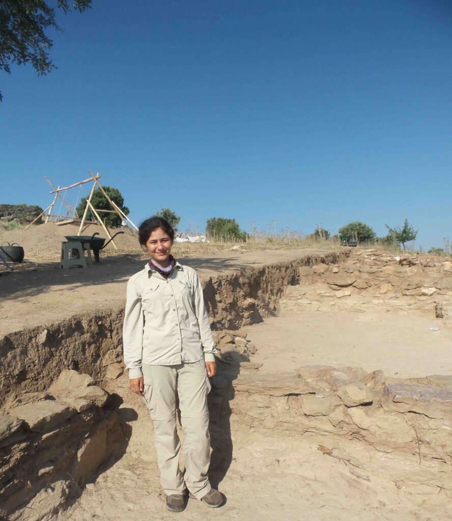
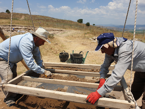
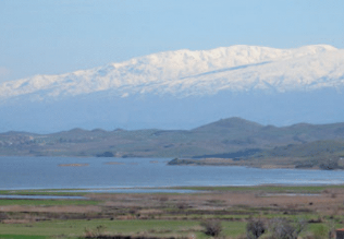
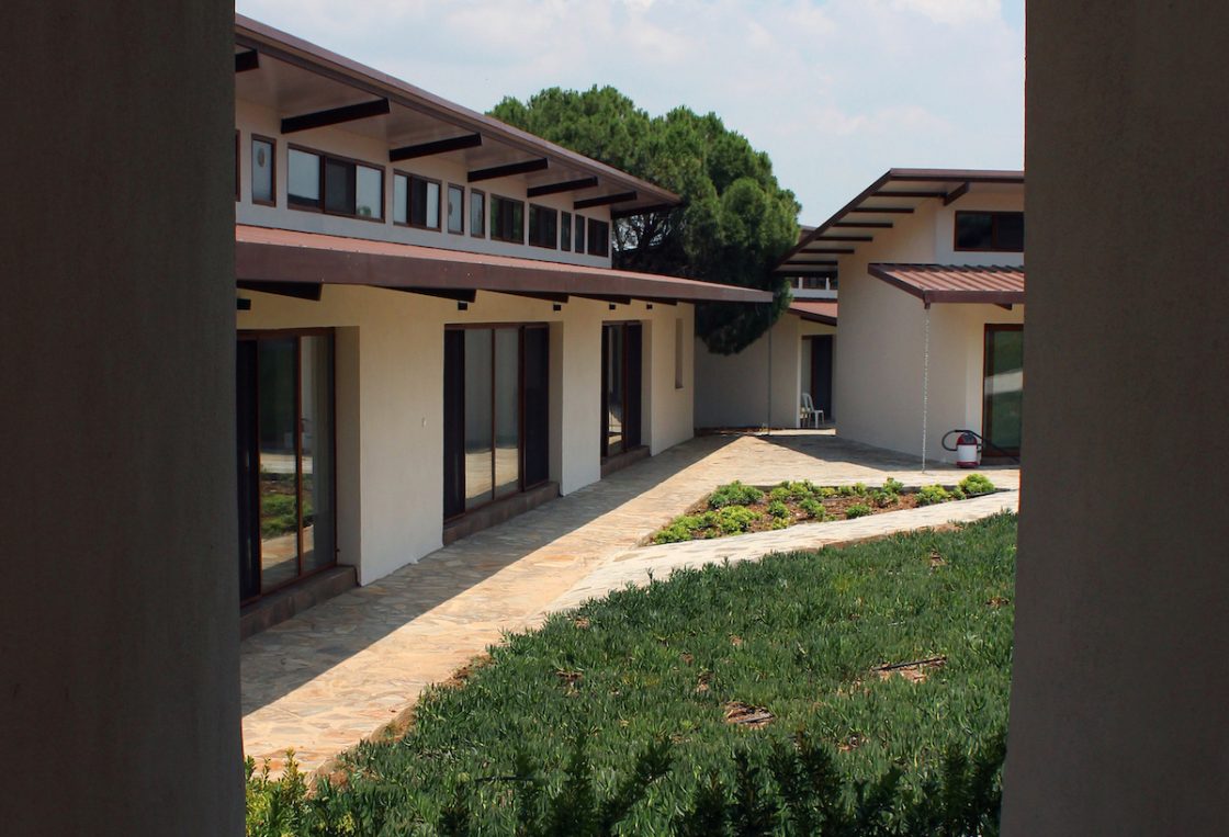
The research center, which among other activities hosts the archaeological mission working at the nearby site of Kaymakçı during the summer months, is located near the village of Hacıveliler in Gölmarmara, Manisa. Overlooking Lake Marmara, the complex consists of different buildings including dormitories, a kitchen and dining room, and work rooms and laboratories for various projects.
Designed by Tim Frank, the architecture of the center acts as one with the local setting. This “performance” approach to design allowed Tim to embrace the various elements of the site, especially the north summer wind and the warm morning sunlight, to maintain temperature. The overhangs and passageways between buildings and the tall ceilings allow for air to circulate with the afternoon and evening summer winds. During the fall through early spring, the glass windows capture the sunlight for passive heating. Tim tested each of his designs using computational fluid dynamics. In addition, he worked extensively with all team members to design personal, communal, and working spaces to meet the needs of an interdisciplinary team.

Affiliated team personnel

Tim Frank, Kennesaw State University


Ottoman Studies

Intensive “digging” into the Presidential Ottoman Archives and Robert College-Boğaziçi University Archives in Istanbul has proved to be extraordinarily interesting for the historical importance of Lake Marmara, the Gediz River, and early archaeology in the region (Bin Tepe and Sardis). Current archival research relates to the period between the late 16th and early 20th centuries. The Middle Gediz Valley is a rich territory for Ottoman narratives on climate change, agricultural production, wetland management, and property relations throughout the period under Ottoman rule. Waqfs (pious foundations) controlled major areas of the region. Princes residing in the palace of nearby Manisa from the 15th to the 17th century played major roles in the waqf management of agricultural land in the valley as well as of the waters and surrounding wetlands of Lake Marmara. Unique historical trajectories define land and lake basin management in the face of dramatic climatic shifts during the Little Ice Age. Current research focuses on the Halime Hatun waqf, which included major components of agricultural and lake resources (fishing, reeds, leeches, etc.). Revenue from taxes collected by the waqf funded the Halime Hatun complex in Gölmarmara, including a mosque, medrese, soup-kitchen, and hammam. These places are today part of Gölmarmara’s Ottoman heritage. The dynamic landscapes of the lake basin offer a hub for exploring the varying scales of global climate shifts among local, imperial, and inter-imperial actors.

In fact this research also gives us the opportunity to place this region firmly within the networks of 18th century Izmir, a major commercial port that connected the middle Gediz Valley to the wider world. This entry triggered increasing competition over land and lake management in the late 18th and thru the early 20th century. Here our work explores Ottoman and non-Ottoman merchants; tax-farmers who competed to gain access to revenues from Lake Marmara, the fertile land, and mines; Cossack refugees who settled in the region as early as the 1830s and made good use of their expertise of socio-ecological knowledge on wetland ecologies to compete with the predominantly Orthodox Greek fishing communities; and local ayan families like the Karaosmanoğlu, who held economic as well as political power in the region. While trying to access and control the resources in the valley, and especially of Lake Marmara, lake communities (intentionally as well as unintentionally) negotiated the micro-climate of the valley and the natural history of Lake Marmara within the context of changing climate and property relations, notably the Tanzimat shifts. This eventually resulted with the emergence of lake management policies.

Finally, another important and emerging part of our archival work focuses on the narratives of early archaeologists, from Bin Tepe to Sardis. We’re interested in their agendas, their engagement with modernity, their relationships with Ottoman officials, and the role of conservation and presentation in Turkey, from the late 18th through the mid-20th century.

Affiliated team personnel

Semih Çelik, Koç University


Metals

Within the various categories of small finds, metal objects play a fundamental role in the reconstruction of everyday practices, craft activities, technological skills, and stylistic choices in ancient cultures. At Kaymakçı, as elsewhere across Anatolia in the second millennium BCE, the metal corpus includes mainly lead and copper-alloyed artifacts, ranging from tools to personal ornaments and weaponry. The abundant presence of small tools such as chisels, awls, and needles testifies to the richness and variety of specialized on-site activities, such as textile production. Stylistic elements of both utilitarian and more prestigious items show a combination of local elements as well as influences from Anatolian and Aegean cultural spheres.

All metal finds from Kaymakçı are typologically examined and categorized to trace differences and similarities with the same categories of artifacts from contemporary sites in other regions. In addition, archaeometric methods of analysis (pXRF, SEM-EDXRF, LIA, etc.) are applied to examine the elemental composition, microstructure, and isotopic signature of metal objects to better understand the technological skills, manufacturing choices, and routes of raw material procurement behind their making.

Affiliated team personnel

Dalila Alberghina, Koç University
Caitlin O’Grady, University College London
Magda Pieniążek, Tübingen University


Landscapes

When the Central Lydia Archaeological Survey (CLAS) began, the backbone of the research focused first and foremost on the concept of landscape – a holistic vision of place-making by those inhabiting this region. Change over time, from conceptual understandings to the physical transformation of the landscape, has resulted in shifting ideas for how communities referred to concepts of home and territory. From settled communities to transhumance, rich narratives of the ebbing and flowing of human heritage define this region. From the forests and lakes of the Bozdağ Mountain range, the vast Gediz River plain, the various rivers (Gediz and Alaşehir), the extensive Lake Marmara, and the uplands of the western and northern mountain ranges, our holistic interest continues to be the layers of legacies embodied across these landscapes.

Affiliated team personnel

Christina Luke, Koç University
Chris Roosevelt, Koç University


DNA: Ancient and Sediment DNA Studies

The scope of ancient DNA studies aims to study genetic characterizations of archaeobotanical material recovered from excavations at Kaymakçı and sediments taken from cores covering the Marmara Lake basin, nearby ridges and uplands, and the Gediz plain. The goal is to assess genetic changes that have occurred over time, often due to domestication, from prehistory to yesterday.

The main goals of the Ancient (aDNA) and Sediment DNA (sedaDNA) research group are as follows: i) to obtain high quality ancient DNA for use in genomic studies, we work with carbonized seeds (e.g., wheat, barley, chickpea, bitter vetch, and grape) retrieved from controlled excavations; ii) to screen agronomically important gene regions for evolutionary changes and the agronomic character of the ancient DNA of agricultural plants and to compare these with their contemporary relatives, this work aims to uncover changes in specific crop plants, notably genetic variation from ancient species to the present; this information will shed light on future agricultural activities; iii) obtaining information about the agricultural and vegetational history of the region through genetic analysis of sedaDNA extracted from a series of strategically placed sediment cores across the Marmara Lake Basin and the Gediz plain, our goal is to examine the population dynamics of existing plants and thus to generate information that can answer important questions on past and present breeding processes of specific crops.

Affiliated team personnel

Zeki Kaya, Middle Eastern Technical University
Asiye Çiftçi, Middle Eastern Technical University
Funda Özdemir Değirmenci, Middle Eastern Technical University
Çiğdem Kansu, Tekirdağ Namık Kemal University


Digital Recording & Database

From the beginning of survey work in 2005 to present excavation work, we have always strived to remain at the forefront of developing, cutting-edge technologies that can transform the ways archaeology is practiced and the archaeological record is interpreted and presented. Efforts began during survey work with handheld GNSS, digital photography, Geographic Information Systems, and database integrations, and subsequently transitioned to “paperless” solutions, including tablet recording of field data, whether from pedestrian field survey, geophysical survey, or excavation.
In 2014, we continued this work with the debut of a holistic digital recording solution for Kaymakçı: the KAP Recording System. Leveraging the connectivity provided by a solar-powered point-to-point network spanning several kilometers, a centralized PostgreSQL database stores data input via a combination of MS Access forms, bespoke Android apps for field and laboratory photography, and GNSS equipment. While the hardware and software that supports the system has been updated and modified slightly over the years, the primary architecture of the system endures, providing the foundation for the integrated workflows that define our teamwork.

Affiliated team personnel

Gary Nobles, Oxford Archaeology
Catherine Scott, Brandeis University
Tunç Kaner, Koç University